STEP 1. Data Collection
To collect the information needed for developing the Rainwater Harvesting map, the first step is to define the datasets that are needed to answer your specific question and collect the data accordingly. If you are interested in the Rainwater Harvesting potential in your area, in general two types of information should be combined to assess this:
- Need factors: where is the demand for rainwater harvesting largest and most urgent?
- Success factors: where rainwater harvesting is most feasible and will most probably be successful?
Datasets
Each of these two factors can be divided into underlying datasets. It is important to concentrate on the most relevant ones, but at the same time be practical on which data is available and relatively easy to obtain. The following seven datasets are considered the most relevant:
- Need factors: population density, land use, access to other water source and aridity
- Success factors: annual rainfall, variation in rainfall and soil drainage
Adding Data
Obviously, more information can be added if specific questions have to be answered. Datasets that you can include for these more tailored assessments are, for example, groundwater quality, GDP per capita, or gender aspects.
To cope with changing situations (climate, socio-economic), a more dynamic approach to the analysis could also be considered. For example, you can still use this GIS mapping method when you want to evaluate the impact of climate change on your Rainwater Harvesting potential by adjusting precipitation and evaporation data, reflecting climate change.

STEP 2. Assigning Scores and Weights
Having collected the correct data, you need to assign scores and weights to these datasets, as not all datasets might be equally important for the analysis. A GIS expert can help you putting the data in a GIS model and advise you on assigning scores and weights.
1. Suitability Scores
First, different suitability scores have to be assigned to the seven datasets in order to combine them to come up with a clear overview of Rainwater Harvesting potential in your area.
How does this work?
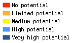
Datasets are always scored between 0 and 1, with 0 as the lowest suitability and 1 as the highest. If you look at the dataset of population density for example, you can assume that the more people live in an area, the higher is the need for Rainwater Harvesting. In this case, you could score as follows:
- A population density between 0 and 100 people per km² = score is between 0.0 and 0.9
- A population density higher than 100 people per km² = score is 1
2. Adding Weight
Secondly, weighting factors can be added to these suitability scores to reflect study specific preferences.
How does this work?
The guiding principle with adding weights is that you give higher weights to the more relevant datasets in your study. For example, when your study focuses on reaching the most remote populations in the region, the suitability class for “population density” will get a lower weight. The weights that should be assigned to the datasets need to be between 0 and 1. Remember that the sum of all weights is always 1.
The results of this scoring analysis are two maps: one with the need for Rainwater Harvesting and another for the potential success of implementing Rainwater Harvesting. Together, these form the basis for the third step.
STEP 3. Combining & Analysing Data
Once the suitability scores and weights for both groups of datasets (the need factors and success factors) have been assigned, in this third step you can combine the datasets to find out the Rainwater Harvesting potential of your specific area.
To do so, all seven datasets need to be converted into maps with the values assigned to the parameters. A GIS expert can help you with this. For each map, the suitability score is multiplied with its corresponding weight. The different layers can then be combined into one overlay: a map that shows the potential and feasibility for Rainwater Harvesting in a specific area or country.
Presenting the Maps
Once you have combined the maps and analysed the outcome, think about how you will present the GIS maps. This can be done in different ways and for different audiences. The maps can be presented separately to show interesting information in one or more maps, for example a comparison of the situation now and in 20 years. Combining all maps will give you the best overview of opportunities, potential and feasibility of integrated Rainwater Harvesting suitability.